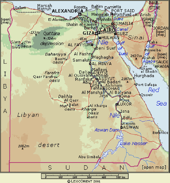
| The major part of Egypt is located north east of
Africa with Sinai lying in Asia which enabled Egypt
to be the link between Europe and both Africa and
Asia. This location also had a major impact on the
Egyptian civilization as it benefited significantly
from the different cultures of neighbouring
countries for thousands of years.
Egypt has also long shores on the Mediterranean
and the Red sea which has helped in the openness of
the country to foreign people contrary to other
people in the region.
Egypt area is 1,002,450 Sq Km but with the desert
constituting more than 90% of it. Although the
population is 79 million (2010 estimate), it is not
distributed evenly as most of the people (99%) live
in the Nile valley, delta and the North coast of the
Mediterranean. Only 380,000 people live in Sinai
peninsula and the inhabitants of the Red sea area is
approximately 288,000 people.
Roads in Egypt constitutes a network of
approximately 48,000 km covering all inhabited areas
of the country and extending to remote areas on the
borders. The railway network has a total distance of
9500 km consisting of 28 lines.
The following map of Egypt shows the highways and
railroads network covering most parts of the country

Egypt road and railway map
Egypt is divided into 29 governorates. Although
the capital Cairo area is only 214 sq. km., the
population is the largest estimated at 6.7 million
people making it a house for 8.5% of the total
Egyptian people.
Egyptian governorates are as
follows (in Alphabetical order)
| Alexandria |
Fayoum |
New Valley
(El Wadi El Gadid) |
South Sina |
| Aswan |
Gharbia |
North
Sinai |
Suez |
| Asiut |
Giza |
Port Said |
Luxor |
| Behira |
Ismailia |
Kaleyoubia |
Helwan |
| Bani Suif |
Kafr El
Sheikh |
Qena |
6th
October |
| Cairo |
Matrouh |
Red Sea |
|
| Dakahlia |
Menia |
Sharqia |
|
| Damietta |
Menoufia |
Sohag |
|
|